




부산북부경찰서 경찰관 A씨, 네팔 등 빙하 재난 3건 분석…25초·150초 주기 공진 가설 제시
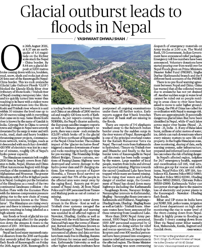
지난 8월 네팔과 중국 국경 지역에서 발생한 대규모 빙하·암석 붕괴와 홍수 참사를 계기로 지진파의 공진 현상을 활용한 재난 조기경보 체계 구축 필요성이 제기됐다.
특히 대규모 붕괴 과정에서 발생하는 지진파의 주기적 특성을 분석하면 기존 관측망을 활용해 재난 발생 가능성을 사전에 포착할 수 있다는 가설이 제시돼 관심을 끌고 있다.
27일 부산북부경찰서 경찰 간부이자 재난방재 분야 독립 연구자인 A씨가 작성한 연구보고서에 따르면, 그는 2023년 인도 시킴과 2024년 및 2026년 네팔에서 발생한 대형 빙하 재난 3건을 대상으로 지진파의 주기적 특성과 공진 가능성을 분석했다.
A씨는 이들 재난에서 약 25초와 150초의 장주기 파동 특성이 반복적으로 나타났다고 지적했다. 지진파가 주변 지형과 빙하·수체에 전달되는 과정에서 특정 주파수의 진동이 증폭되는 공진 현상이 붕괴 과정에 영향을 미쳤을 가능성이 있다는 설명이다.
당시 해발 5,000m 이상의 고산지대에서 거대한 빙하와 암석층이 붕괴하면서 토사와 얼음이 하천으로 쏟아져 내렸다. 이 과정에서 형성된 일시적인 하천 차단 구조물이 무너지며 대규모 홍수가 발생해 하류 지역을 덮쳤다.
급류는 네팔 라수와 지역의 티무레와 라수와가디 등 국경 마을을 휩쓸었으며, 도로와 교량, 수력발전 시설 등 주요 기반시설에도 막대한 피해를 입혔다.
당시 지진관측 장비에는 오전 8시 37분께 강한 지진 신호가 기록됐으며, 약 7분 뒤 국경 지역에 홍수가 도달한 것으로 분석됐다.
다만 미국 지질조사국(USGS)과 현지 연구기관 등의 후속 분석에서는 해당 지진 신호가 일반적인 지각 지진이 아니라 대규모 빙하·암석 붕괴 과정에서 발생한 것으로 해석됐다.
A씨는 이처럼 대형 붕괴 과정에서 강한 지진파가 관측된다는 점에 주목하면서, 붕괴 이전부터 특정 주기의 진동 에너지가 축적되는 현상이 존재하는지 규명할 필요가 있다고 주장했다.
그는 특히 지진파의 공진 정도를 나타내는 Q값이 높아지는 현상을 위험 신호로 활용할 수 있다는 가설을 제시했다.
A씨의 보고서에는 평상시 수십~1,000 수준인 Q값이 1만 이상으로 상승할 경우 주의보를 발령하고, 7만5,000 수준에 도달하면 경보를 발령하는 방안이 담겼다.
이를 바탕으로 재난 발생 12시간 전 주의보, 6시간 전 경보, 붕괴 임박 시 비상 대응으로 이어지는 3단계 조기경보 체계를 구축하자는 제안이다.
A씨는 기존 지진관측 장비에 주파수 분석 및 공진 상태를 평가하는 소프트웨어를 추가하면 별도의 대규모 관측시설을 신설하지 않고도 관련 감시체계를 구축할 수 있을 것으로 기대했다.
공학적 대응 방안도 제시했다.
빙하호 주변의 공진 에너지를 감소시키는 감쇠 시설을 설치하거나 수위 조절을 통해 공진 조건을 변화시키는 방식이다.
다만 수위 조절 과정에서 오히려 진동이나 붕괴를 촉발할 가능성도 있는 만큼 정밀한 유체역학 분석과 사전 시뮬레이션이 필요하다는 설명이다.
이번 네팔 참사와 관련해 현지에서도 국경을 넘나드는 재난 위험 정보의 공유와 조기경보 체계 개선 필요성이 제기된 바 있다.
네팔 적십자와 국제산악종합개발센터(ICIMOD) 등은 대규모 빙하·암석 붕괴가 하류 지역에 심각한 피해를 일으켰다고 분석했으며, 국경 지역의 재난 감시 및 대응체계 강화 필요성을 강조하고 있다.
A씨는 이번 연구 내용을 담은 보고서를 통해 유엔 재난위험경감기구(UNDRR) 등에 실시간 공진 모니터링과 국제 공동연구의 필요성을 제안했다고 밝혔다.
한편 이번 보고서의 핵심인 25초·150초 주기 공진 현상과 붕괴 원인 사이의 인과관계는 아직 독립적인 과학적 검증이 확인되지 않았다.
특히 대규모 붕괴 자체가 지진파를 발생시킬 수 있다는 기존 연구 결과를 고려하면, 붕괴 이전의 전조 신호와 붕괴 과정에서 발생한 진동을 구분하는 작업이 필요하다.
아울러 Q값의 산출 방법과 실제 재난 예측 성공률 등에 대한 추가 검증도 요구된다.
A씨는 "대형 재난 발생 이전에 특정 주기의 공진 현상이 지속적으로 강화되는지를 확인하는 것이 중요하다"며 "기존 지진관측망의 데이터를 활용해 붕괴 전조를 조기에 탐지할 수 있는지 국제적인 공동연구가 필요하다"고 밝혔다.
----------------------------------------
-Seismic Wave Resonance Hypothesis Raises New Questions About Himalayan Glacier Disasters-
South Korean police officer proposes early warning system based on 25-second and 150-second wave patterns observed in three Himalayan disaster cases
Research suggests existing seismic monitoring networks could support a three-level warning framework, but independent scientific validation remains necessary
A South Korean police officer conducting independent disaster research has proposed a seismic wave resonance hypothesis that could offer a new approach to detecting early warning signals of catastrophic glacial floods in the Himalayan region.
The proposal follows a devastating flood in the Nepal-China border region on August 26, 2026, when a massive rock and ice avalanche triggered destructive flooding downstream, damaging villages, bridges, roads and hydropower infrastructure.
According to a research paper prepared by a police officer at Busan Bukbu Police Station, who is also an independent researcher in disaster prevention and wave dynamics, certain long-period seismic signals may provide clues to the physical processes associated with catastrophic glacier-related events.
The researcher, identified as Officer A, examined three major Himalayan disaster cases: the South Lhonak glacial lake outburst flood in Sikkim, India, in October 2023; the Thame flood in Nepal in August 2024; and the Rasuwa disaster near the Nepal-Tibet border in August 2026.
The paper, titled Cause Analysis of Glacier Lake Collapse (GLOF) via Crustal Wave Resonance & Real-Time Q-Value Early Warning Guidelines, proposes that seismic wave resonance may contribute to energy accumulation in vulnerable glacial environments.
Officer A reported identifying recurring wave periods of approximately 25.01 seconds and 150.04 seconds across the three cases.
The researcher suggested that seismic energy transmitted through the Earth's crust could interact with glacial lakes, surrounding geological structures and water bodies, potentially amplifying vibrations under certain conditions.
Such interactions, the paper argues, may contribute to structural instability in natural barriers formed by ice, rock and glacial debris.
However, the existence of these specific resonance patterns and their proposed causal relationship with glacier collapse have not yet been independently verified.
The August 2026 disaster in Nepal provides a particularly important case for further investigation.
At approximately 8:37 a.m. local time, seismic instruments recorded a strong signal associated with a massive rock and ice avalanche in the high-altitude border region.
A destructive flood subsequently swept through downstream communities, including areas around Rasuwa and Timure.
Subsequent scientific assessments indicated that the seismic signal was likely generated by the large-scale avalanche itself rather than by a conventional tectonic earthquake preceding the collapse.
This distinction is important because seismic waves recorded during a catastrophic event do not necessarily demonstrate that resonance caused the disaster.
Officer A nevertheless argues that examining seismic signals recorded before major collapses could help determine whether measurable changes in wave energy occur during the buildup to such events.
A central element of the proposal is the use of the seismic quality factor, commonly known as the Q-value, as a potential indicator of resonance-related energy behavior.
In the researcher's proposed model, Q-values could rise from background levels of approximately 60 to 1,000 to substantially higher levels under conditions of sustained resonance.
The paper suggests that values approaching 10,000 could indicate an initial warning stage, while levels near 75,000 could represent a more critical condition.
Based on these proposed thresholds, Officer A outlined a three-level early warning framework.
The first stage would issue an advisory approximately 12 hours before a potential disaster, allowing authorities to prepare emergency responses and alert downstream communities.
The second stage would issue a more serious warning approximately six hours before a possible collapse, providing time for evacuation and the deployment of rescue resources.
The third stage would involve immediate emergency measures if monitoring systems detected signals interpreted as indicating imminent structural failure.
The proposed warning intervals and numerical thresholds remain theoretical and have not been demonstrated to reliably predict real-world glacier disasters.
One of the central features of the proposal is its potential use of existing seismic monitoring infrastructure.
Rather than installing an entirely new network of monitoring equipment, the researcher suggests upgrading software at existing seismic stations to analyze long-period signals, moving-average seismic amplitudes and Q-value changes in real time.
The paper also recommends examining seismic signals with periods ranging from 20 to 200 seconds, including signals that may be filtered out or treated as background noise during conventional seismic analysis.
According to the researcher, coordinated analysis across multiple seismic stations could help identify whether unusual wave patterns are localized, persistent and potentially associated with vulnerable mountain environments.
The paper additionally proposes several engineering approaches intended to reduce resonance-related risks.
These include installing wave-dissipating structures, investigating controlled drainage of glacial lakes and studying whether changes in water levels could alter potentially hazardous resonance conditions.
However, the researcher acknowledges that interventions such as controlled drainage or externally induced vibrations could themselves create additional hazards if implemented under unstable conditions.
Detailed fluid-dynamics simulations, engineering assessments and controlled field studies would therefore be necessary before any such measures could be considered for practical deployment.
The report also calls for greater international cooperation in monitoring glacier-related hazards, particularly in mountainous border regions where upstream disasters can rapidly affect downstream communities in neighboring countries.
Officer A said the research proposal had been submitted to the United Nations Office for Disaster Risk Reduction (UNDRR) and called for international cooperation on seismic monitoring, early warning technologies and engineering research.
Submission of a research proposal to a United Nations agency does not, however, constitute scientific endorsement or official acceptance of its conclusions.
Existing scientific assessments of Himalayan glacier-related disasters have identified factors including rock and ice avalanches, unstable glacial terrain, rising temperatures and the sudden release of water as important contributors to catastrophic flooding.
The proposed seismic resonance mechanism therefore requires further examination alongside these established explanations.
In particular, independent researchers would need to verify the reported 25-second and 150-second wave patterns, assess the methods used to calculate Q-values and determine whether any proposed warning signals consistently appear before major collapse events.
Distinguishing genuine precursory signals from seismic vibrations generated during an avalanche or flood would be essential.
Despite these uncertainties, the research proposal highlights a broader challenge facing disaster-prone mountain regions: identifying reliable early warning signals before rapidly developing hazards leave communities with little time to evacuate.
Whether seismic resonance monitoring can contribute to that effort will depend on further analysis of observational data, independent scientific review and rigorous testing of the proposed prediction methods.
최수아 빅데이터뉴스 기자 chltndk963@thebigdata.co.kr
<저작권자 © 빅데이터뉴스, 무단 전재 및 재배포 금지>